Weather and Climate Resources
The USDA Plant Hardiness Zone Map is the standard by which gardeners and growers can determine which perennial plants are most likely to thrive at a location. The map is based on the average annual extreme minimum winter temperature, displayed as 10-degree F zones and 5-degree F half zones. A broadband internet connection is recommended for the interactive GIS-based map above.
To find the Plant Hardiness Zone at your location quickly, enter your zip code in the Quick Zip Code Search box in the map above, or click anywhere on the map to view the corresponding interactive map.
- For further instructions on using this map, visit How to Use The Maps.
- To view/print national, regional, or state Plant Hardiness Zone Maps, visit Map Downloads.
- To learn about updates to this map from its previous (2012) edition, visit Map Creation.
Western Water Assessment
The Intermountain West Dashboard provides situational awareness of weather, drought, and water resources for Colorado, Utah, and Wyoming.
On their website you can find resources to current reports regarding the following:
- Reservoir Storage and Streamflow Data
- Soil Moisture
- Drought Conditions
- Current Snowpack reports (updated weekly)
Advanced Hydrologic Prediction Service

The National Centers for Environmental Prediction (NCEP) delivers science-based environmental predictions. It produces reliable, timely, and accurate analyses, guidance, forecasts and warnings for the protection of lives and property and the enhancement of the national economy. NCEP is comprised of nine distinct centers including the Aviation Weather Center, Climate Prediction Center, National Hurricane Center, Storm Prediction Center, Space Weather Prediction Center, Weather Prediction Center, Ocean Prediction Center, Environmental Modeling Center, and NCEP Central Operations. NCEP is the starting point for nearly all weather forecasts in the United States.
Water Resources Data System

WRDS serves as the Wyoming State Climate Office (SCO) and, as such, we provide a variety of services ranging from the development of enhanced drought-monitoring products to the online dissemination of water resources publications.
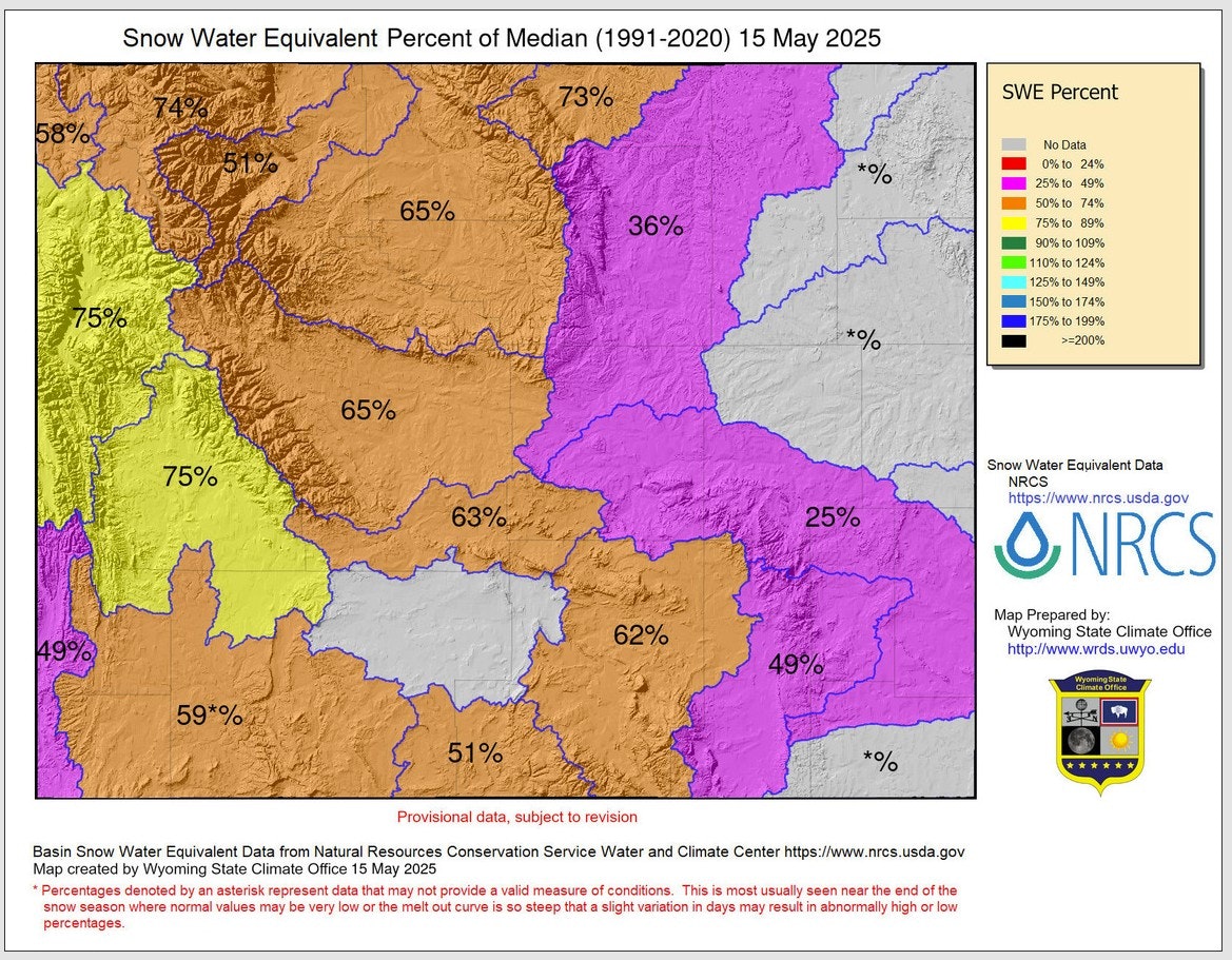
UPDATE AS OF MAY 15TH, 2025:

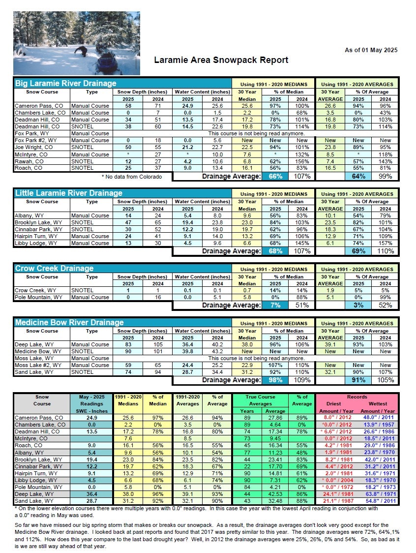
LARAMIE-AREA MONTHLY SNOWPACK REPORT AS OF MARCH 1ST, 2025 :


National Interagency Coordination Center
Located in Boise, Idaho, the National Interagency Coordination Center (NICC) serves as the focal point for coordinating the mobilization of resources to wildland fires and other incidents throughout the United States. The NICC also provides Predictive Services related products designed to be used by the internal wildland fire community for critical decision-making surrounding incident management and resource allocation.
- Access the current National IMSR interactive map here: IMSR Map | National Interagency Coordination Center (nifc.gov)
- Access the Rocky Mountain Area Coordination Center map here: RM GACC Home (nifc.gov)
- Access the Wyoming State Forestry Division's updates here: Forestry Division - Current Fires (wyo.gov)
- Access Albany County's current fire restrictions heer: Fire Restrictions | Albany County, WY (albanycountywy.gov)

